Delivering precision-driven surveying solutions across South Africa
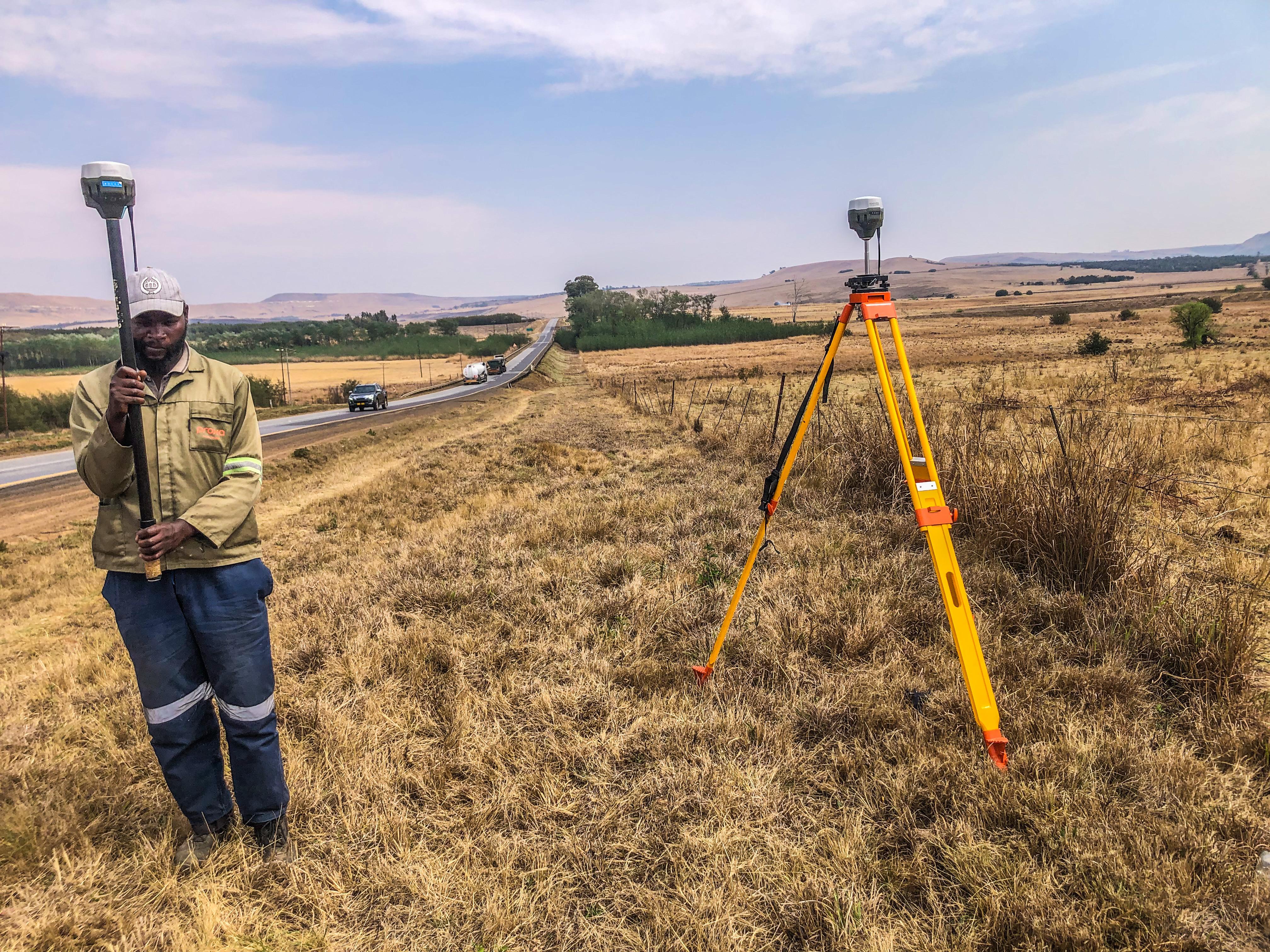
we were appointed to relocate and re-establish a disturbed farm boundary beacons on a registered agricultural property in Krugersdorp. The original beacons had been lost or displaced, creating uncertainty over the legal boundary of the farm. Using Surveyor-General approved diagrams, high-precision GNSS, and total station measurements, the farm boundary was mathematically reconstructed and the beacons were re-positioned in its correct legal location. A permanent survey beacon was installed on site. A Beacon Certificate was issued by a Professional Land Surveyor, legally confirming the position of the boundary point for conveyancing, fencing and future development. This project restored legal certainty to the property boundary and ensured full compliance with South African cadastral regulations..
Gauteng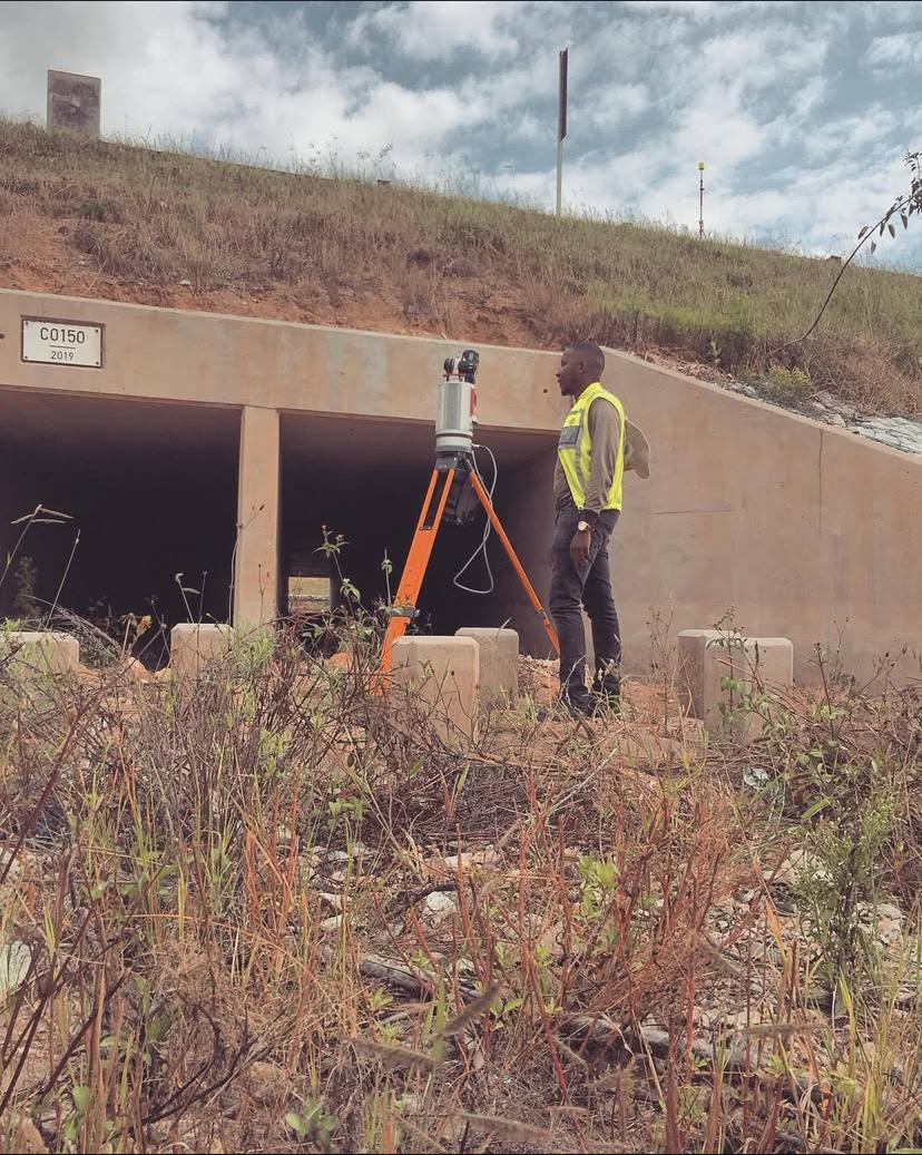
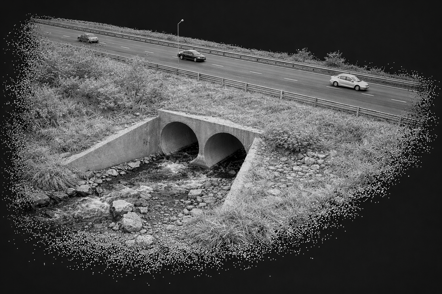
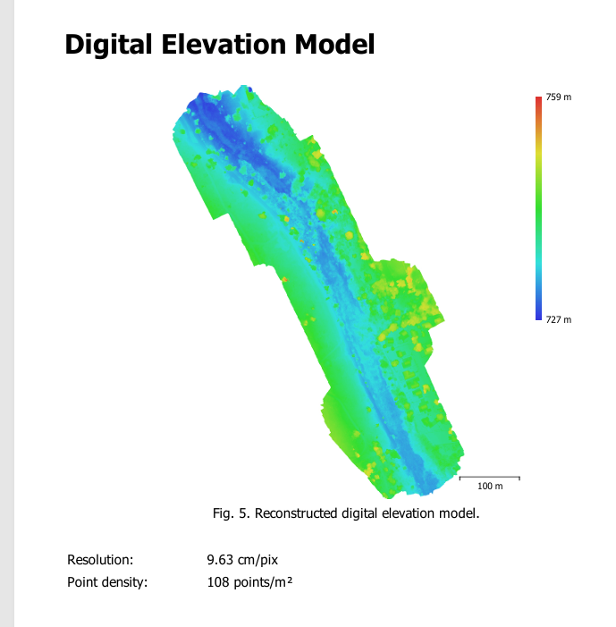
South Aven Land Surveys conducted a high-resolution LiDAR survey of existing structures and terrain along the N2 National Road to support a proposed new development corridor. Using mobile and static LiDAR scanning technology, we captured accurate 3D data of buildings, road infrastructure, and surrounding terrain without disrupting live traffic. The point cloud data was processed into measured building outlines, elevations, and digital terrain models for planning and design purposes. The results provided engineers, planners, and developers with a precise, up-to-date digital representation of the corridor, enabling safe design, impact assessment, and infrastructure planning for the new development..
National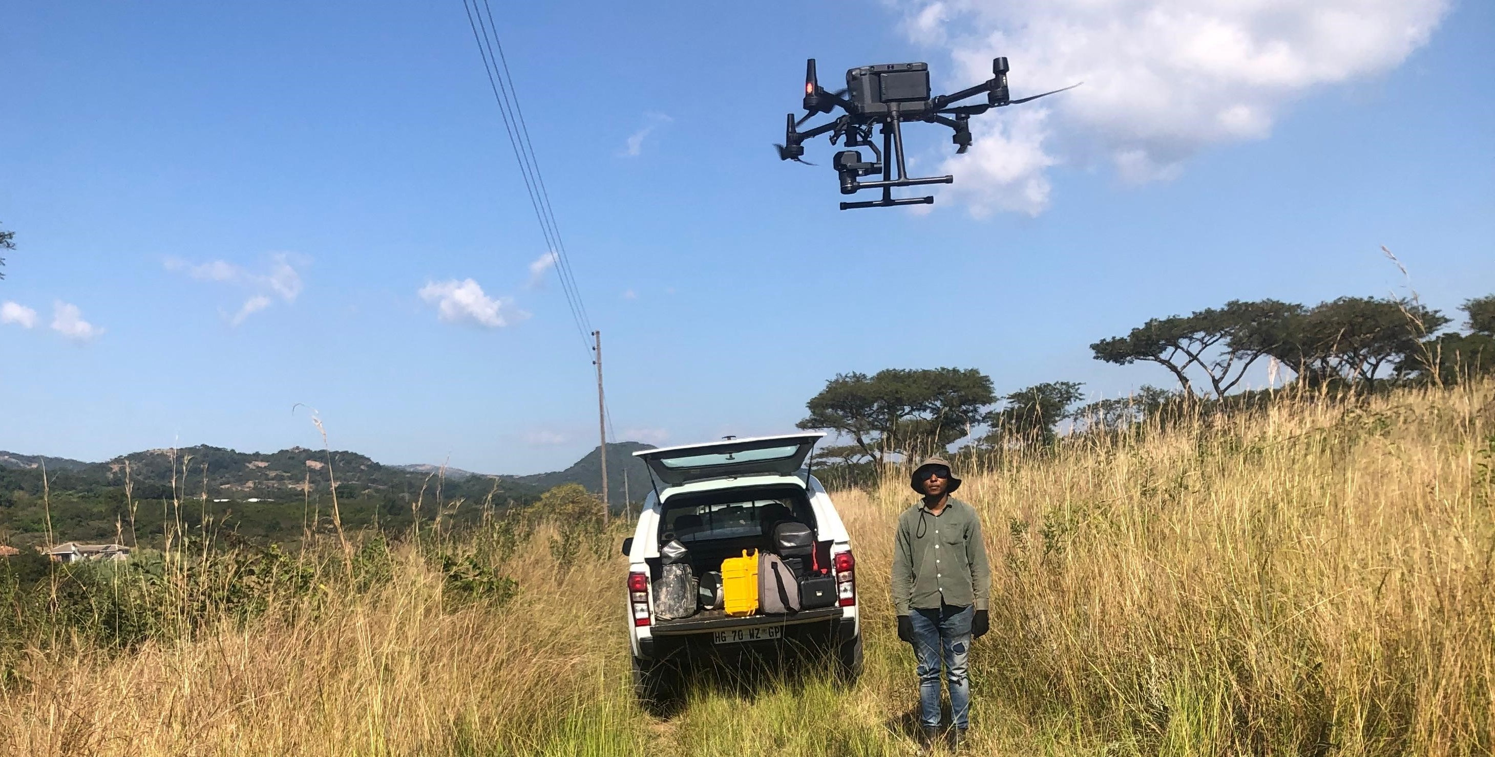
We conducted a drone-based river boundary survey along a densely vegetated section of a river in Mbombela, where traditional ground surveying was limited by thick vegetation and difficult terrain. Using high-resolution drone imagery and photogrammetry, we mapped the river course, banks, to accurately define the legal and physical river boundary. The data was processed into orthophotos, contours, and georeferenced maps for planning and environmental compliance.
Mpumalanga
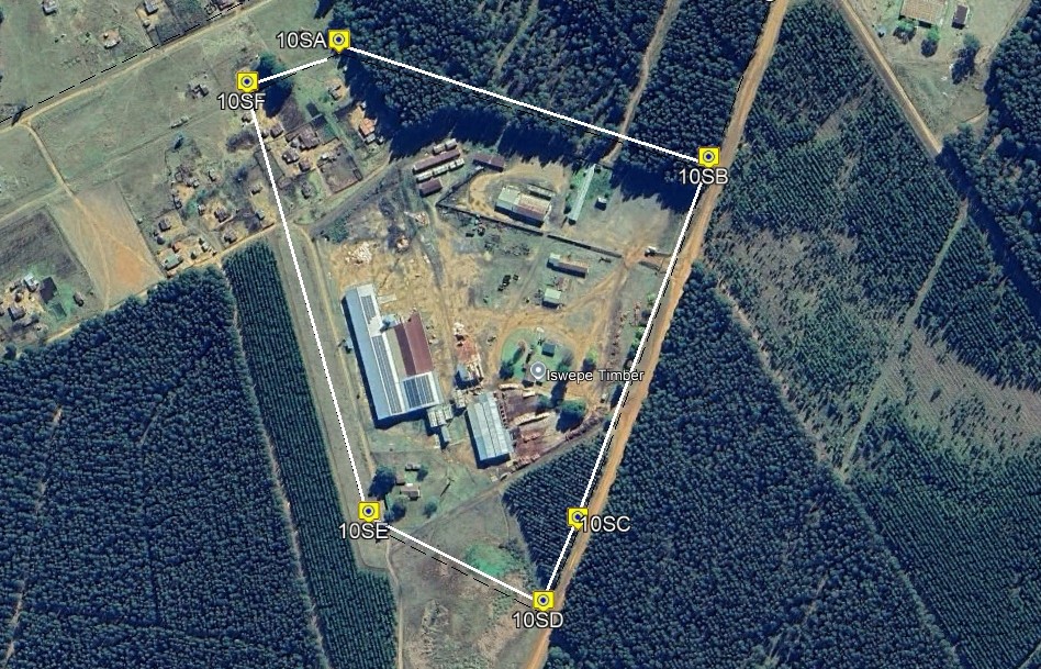
South Aven Land Surveys has successfully completed multiple sectional title projects across Gauteng South, providing comprehensive services for plan preparation, boundary verification, and compliance with the Sectional Titles Schemes Management Act. Our work includes: Preparation of sectional plans and amendments Verification of exclusive use areas, encroachments, and participation quotas Liaising with attorneys, developers, and the Surveyor-General for plan approvals Ensuring accuracy, legal compliance, and efficient registration These projects have enabled developers and homeowners to securely define property boundaries, manage complex schemes, and streamline sectional title registrations across the region.
Gauteng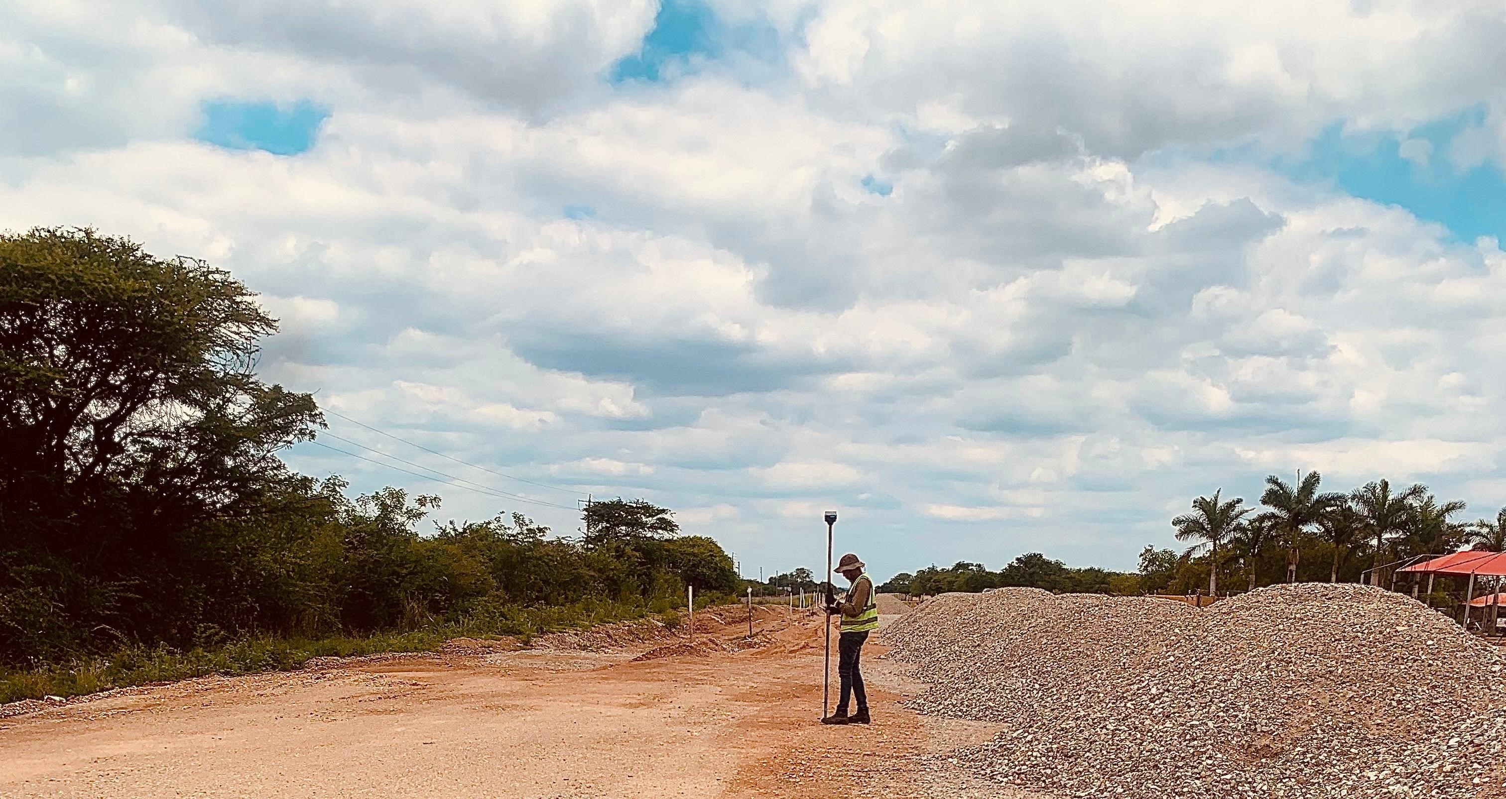
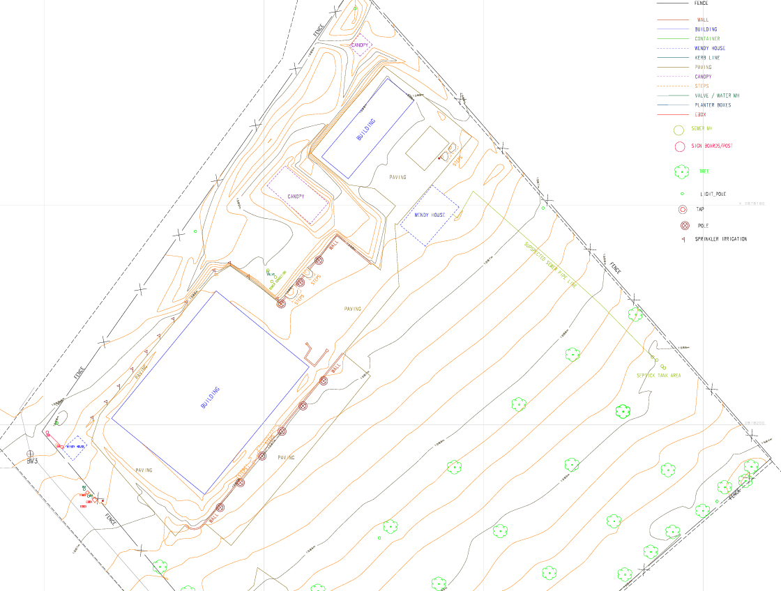
We were appointed to carry out a topographic and engineering survey for the proposed construction of a new access road and the CTH Church development in Johannesburg. The site was surveyed to capture terrain levels, existing roads, drainage features, services, and surrounding structures. Using high-precision GNSS, total station, and ground control, accurate surface data was collected and processed into a detailed topographical and engineering plan. The survey information was used by engineers and designers to design road alignments, earthworks, and stormwater infrastructure, ensuring the access road and church development could be constructed safely, efficiently, and in compliance with municipal standards.
Joburg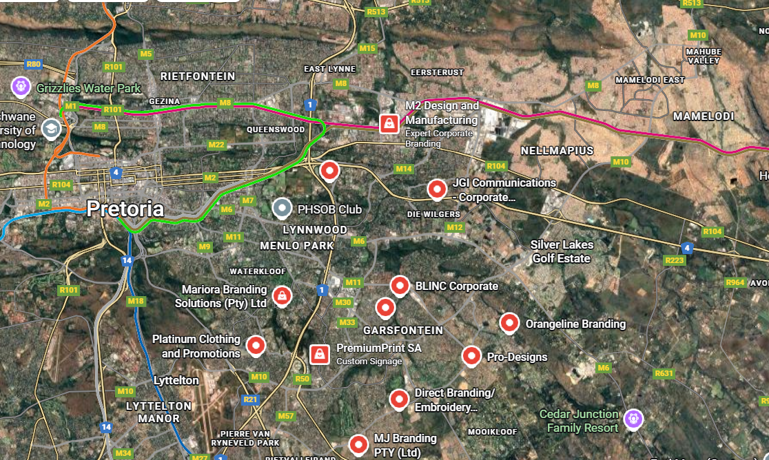
South Aven Land Surveys conducted a GIS-based mapping project for 45th Media, aimed at visualizing their supplier and client network across the country. Using geospatial analysis and route mapping, we plotted the locations of all suppliers and clients, calculated distances and optimal routes, and overlaid them on a geographic map for strategic insights. The deliverables enabled data-driven decision-making, helping 45th Media optimize logistics, plan supply chains, and identify opportunities for growth and efficiency across their network.
South Africa


082 209 3129
sage.mbulazi@southaven.co.za
Midrand, Gauteng
Middelburg, Mpumalanga
Durban, Kwa Zulu Natal